Above is a compilation of all the GPS drawings with the black lines showing
sea-level projection and the red lines indicating the recorded altitude.
The great variation in altitude was caused by disruptions to the satellite signals.
Spectropolis [Exhibition] [Workshop]
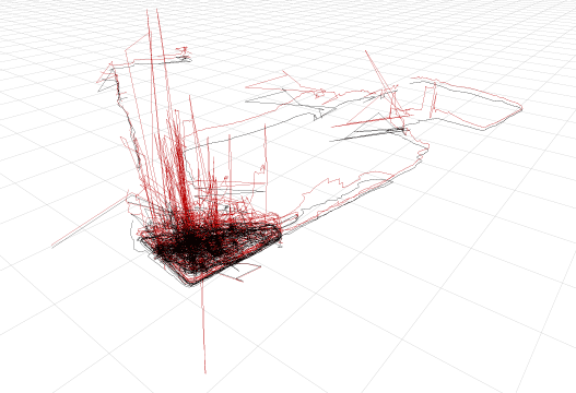
Perspective view of all the drawings in the park, looking south-east
(Grid Increment 100m).
Above is a compilation of all the GPS drawings with the black lines showing
sea-level projection and the red lines indicating the recorded altitude.
The great variation in altitude was caused by disruptions to the satellite signals.

We drew on the north-western tip of Battery Park at the western end of Chambers
Street.
Four sessions:
October 2nd 2004 12-2pm & 2-4pm
October 3rd 2004 12-2pm & 2-4pm
Orthographic view of all the drawings together.

Satellite reception is better on the left-side of the park as is runs along
the New York City Harbor.
The signals recorded on right-side were heavily affected by small trees and
enormous skyscrapers.
Selection of Results:


[top]