
A Helicopter Ride
Location: Oxford, UK
Date: 12/05/01
Track Length: 7.4km
Altitude: 1500ft
Method: Helicopter
Comments: Took off from Cutteslowe Park during the balloon
festival and in seven minutes reached and altitude if 1500ft and speeds of 190
kph for £20. Cheaper than bungee-jumping (£45).
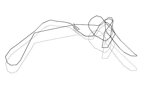
The drawing traces the route taken by many that day on the novelty helicopter
ride.
GPSograph_ Shockwave Viewer
The 3-d renders were created in POV-ray (http://povray.org/)
by parsing the GPS data using the GPSograph.
The render below was to check that the GPS program image aligned itself with
the POV-ray rendered image.


In the foreground on the left is the A40 east of Oxford.
In the bottom right of the frame is part of Cutteslow Park where the festival
took place.
You can see there was still plenty of parking space available in the fields
by late-afternoon.

The pilots own GPS device was not working that day.
It is mounted above the instrument panel next to the dangling novelty airfreshner.